The first AI-Native
Reality Capture Platform
Aerial, Street, Indoors
Managed Service
Full GeoCam capability. Fully managed by us.
GeoCam Australia currently operates as a turnkey capture service, we deploy, capture, and deliver. No hardware for you to manage. Subscription tiers are on the horizon; if your procurement cycle is already ticking, let's talk now.
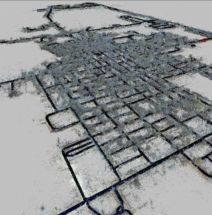
GeoCam is the enterprise ready Reality Capture Platform. Our AI-powered Visual Positioning Engine enables rapid mapping at any scale, no LiDAR.
.png&w=3840&q=75&dpl=dpl_3Ktz2dcvLkvm5CMU1Gzztks3SvaH)
How it works
From field to GIS in four steps.
Capture
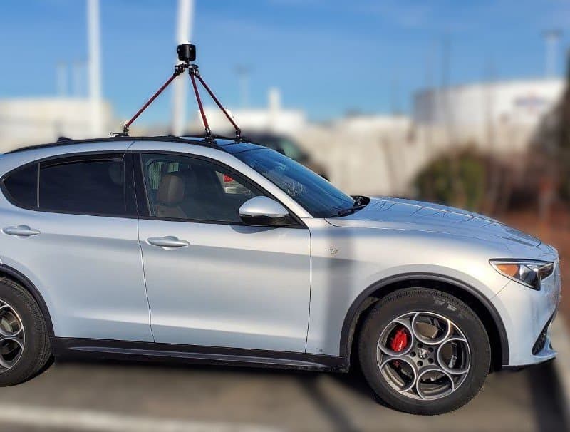
Deploy GeoCam 360 on vehicles, backpacks, drones, or monopoles to collect high-resolution 360° imagery with RTK GNSS positioning.
Manage
Upload, organise, and monitor capture sessions in one centralised platform. Full project management from field to cloud.
Process
AI-powered Visual Positioning Engine automatically aligns and processes imagery at scale. No LiDAR required.
Create
Extract features and create accurate GIS, CAD, and BIM data compliant with Australian standards. Direct ArcGIS integration.
Deploy on any platform, anywhere.
Easy to transition between them and fuse into a single scene.
Drive Streets
Mobile mapping for roads, utilities, and streetscapes with centimetre-level accuracy.
Walk Properties and Indoors
Portable capture for facilities, campuses, and areas inaccessible to vehicles.
.jpg&w=3840&q=75&dpl=dpl_3Ktz2dcvLkvm5CMU1Gzztks3SvaH)
Capture Aerial Imagery
Drone integration for large-scale projects, terrain mapping, and hard-to-reach areas.
Use Cases
Build map data in support of many industries.
Public Works Asset Management
Map and maintain critical street furniture, roadways, assets in parks or along trails, and sidewalks.
Utilities — Electric, Fiber, Water, and Gas
Build Utility Network data from the ground up, faster and more accurately than converting old data.
Public Safety Pre Plans and Maps
Expand inspections creating Fire, Police, and Ambulance Services ready Pre Plan Maps.
Facilities and Property Assessments
No more paper reports and inventories without locations. Create PCA and FCA data using maps.
Construction As Built Models
Continually scan the build process enabling True As Builds, updating designs and creating a super vision.
Dilapidation Surveys
Capture accurate pre and post-construction condition reports with georeferenced imagery. Reduce disputes and protect your business with defensible visual records.
On the Road
Upcoming Events
DistribuTECH 2026
February 2–5, 2026 · San Diego, CA
As utilities face increasing pressure to maintain aging assets, respond to extreme weather, and document field conditions with greater accuracy and speed, GeoCam's reality capture and automated data management solutions help bridge the gap between field operations and enterprise decision-making.
Esri FedGIS 2026
February 10–11, 2026 · Washington, D.C.
As federal agencies increasingly rely on geospatial intelligence to inform planning, compliance, and operational readiness, GeoCam's reality capture and automated imagery management solutions help transform field data into actionable insights.
GeoWeek 2026
February 16–18, 2026 · Denver, CO
As organisations seek faster, more scalable ways to capture, manage, and operationalise visual data from the field, GeoCam brings a practical, mobile-first approach to reality capture that complements LiDAR, photogrammetry, and GIS workflows.
Stay Updated
Keep up with all the amazing developments we have coming up.
Australian infrastructure moves fast. So do we.